A Nature Lover’s Paradise – Best hikes in Gran Canaria
Welcome to Gran Canaria, a gem in the Canary Islands known for its diverse landscapes, breathtaking views, and fantastic hiking trails. While many people come for the beaches, those who venture inland will discover the island’s hidden gems. If you’re adventurous and eager to explore Gran Canaria’s natural beauty and stunning panoramas, we’ve got some great hikes for you. Whether you’re a seasoned hiker or just starting, here’s your friendly guide to the best places hiking trails in Gran Canaria. Enjoy the island!
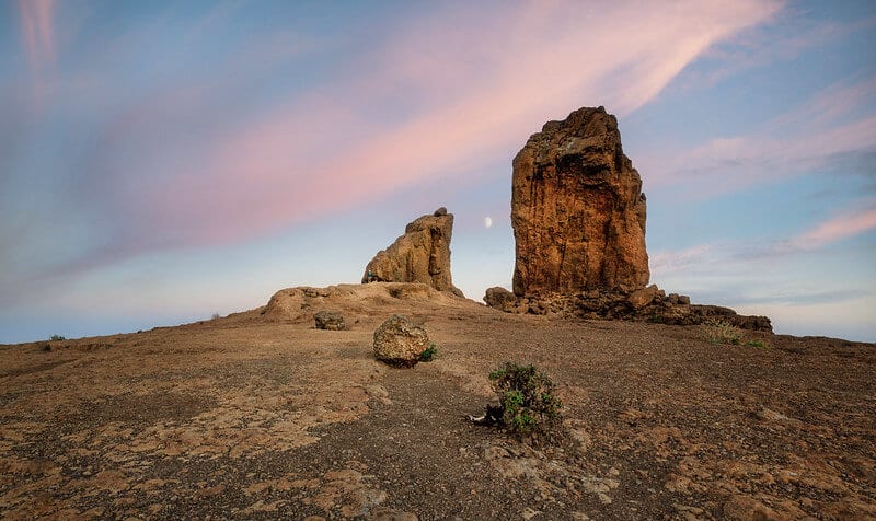
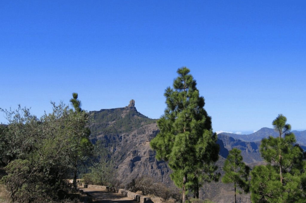
1. Roque Nublo: The Iconic Landmark
Roque Nublo is one of the most iconic natural landmarks in Gran Canaria. It’s like going to Paris and not checking the Eiffel Tower. This towering volcanic rock rises 80 meters high and provides breathtaking panoramic views of the island. While Roque Nublo itself is a popular spot, there are hidden trails around the area that offer a more peaceful and equally beautiful experience. Explore these paths to enjoy the serene landscapes and take in the amazing views of the iconic rock and the island’s diverse scenery.
Hike Overview:
- Location: Tejeda, Gran Canaria, Canary Islands, Spain
- Trailhead: The hike begins at the La Goleta parking area, which has ample space for cars.
- Elevation: Approximately 1,813 meters (5,948 feet)
- Difficulty: Moderate
- Duration: 1.5-2 hours round trip, depending on pace
- Best Time to Hike: Year-round, with clear days offering the best views
- Trail Description: The trail to Roque Nublo is well-maintained and marked. It starts with a gentle incline through a forested area, gradually becoming steeper as you approach the rock formation.
Points of Interest
- Roque Nublo: The rock itself is the main attraction. Climb to the base of the formation to fully appreciate its size and unique shape.
- El Fraile: A smaller rock formation nearby, often referred to as “The Monk” due to its distinctive shape.
- 360-Degree Views: From the summit plateau, enjoy panoramic views of Gran Canaria, including views of Teide on Tenerife on clear days.
- Pine Forest: The initial part of the hike passes through a beautiful Canary Island pine forest, providing shade and a serene atmosphere.
Tips:
- Wear sturdy hiking boots as the trail can be rocky.
- Bring plenty of water and a snack to enjoy at the summit.
- You may sometimes find a van at the beginning of the trail selling typical Canarian snacks. It’s the perfect spot to grab a small snack and sample the local flavors before you start your hike.
- Be aware that descending after dusk may leave you without enough natural light. Bring a phone torch or rely on moonlight and the night sky for a safe descent.
2. Pico de las Nieves: The Highest Peak
Pico de las Nieves, standing as the highest peak on Gran Canaria, offers hikers an unparalleled vantage point to explore the island’s diverse landscapes. At an elevation of 1,949 meters (6,394 feet), it provides breathtaking views and a challenging yet rewarding hiking experience. Here’s a comprehensive guide to help you plan your hike to Pico de las Nieves.
Hike Overview
- Location: Center of the island
- Trailhead: Common starting points include the Degollada de la Goleta and Llanos de la Pez
- Elevation: 1,949 meters (6,394 feet)
- Difficulty: Moderate to challenging
- Duration: 3-4 hours round trip, depending on the chosen route and pace
- Best Time to Hike: Every Year Round
Points of Interest
- Observation Deck: At the summit, enjoy panoramic views of Gran Canaria, including Roque Nublo, Tejeda, and on clear days, Mount Teide on Tenerife. Excellent point for photography and taking in the views.
- Flora and Fauna: The diverse microclimates support unique plant and animal life. Look for native species like the blue chaffinch and various endemic plants.
Tips:
- The weather can be cooler at higher altitudes, so bring a jacket, it’s the highest point of the island.
- A camera is a must for capturing the breathtaking views.
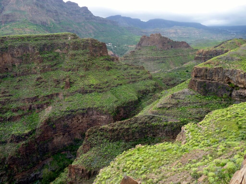
3. Barranco de Guayadeque: A Journey Through History
Guayadeque Valley,is one of Gran Canaria’s most enchanting and historically rich ravines. This picturesque valley, stretching between Agüimes and Ingenio, is renowned for its natural beauty, ancient cave dwellings, and cultural significance. Here’s a detailed guide to help you explore Barranco de Guayadeque and immerse yourself in its historical journey.
Hike Overview
- Location: Between the municipalities of Agüimes and Ingenio, Gran Canaria, Canary Islands, Spain
- Trailhead: Common starting points include the towns of Agüimes and Ingenio
- Elevation: Varies along the trail, with moderate inclines
- Difficulty: Easy to moderate
- Duration: 2-4 hours round trip, depending on the chosen route and pace
- Best Time to Hike: October to May, avoiding the summer heat, also the island itself is greener.
- Trail Description: The trails are well-marked and take you through a lush valley with abundant flora, cave dwellings, and historical sites.
Points of Interest
- Cave Houses: Visit the cave houses, some of which have been converted into museums, showcasing traditional Canarian life.
- Archaeological Sites: The ravine is dotted with significant archaeological sites, including burial caves and ancient artifacts.
- Chapel of San Bartolomé: This small chapel carved into the rock is a serene spot for reflection and offers insight into the area’s religious history.
- Restaurant Tagoror: Built into a cave, this restaurant offers a unique dining experience with traditional Canarian cuisine.
- Visitor Center: Start your visit here to learn about the ravine’s history, geology, and cultural significance.
Tips:
- Perfect for a half-day adventure with family.
- Consider having lunch at the cave restaurant for a unique dining experience.
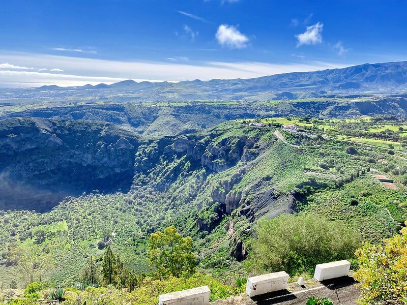
4. Caldera de Bandama: A Volcanic Wonder
Near Santa Brígida in the northeast, the Caldera de Bandama offers an easier yet equally stunning hiking experience. This volcanic crater is a geological marvel, with a trail that descends into the crater itself. The unique landscape within the caldera and expansive views from the rim make it a fascinating hike for geology enthusiasts and nature lovers alike.
Overview
- Location: Near Las Palmas approx 20 minutes from the city
- Trailhead: Bandama Golf Club parking area. The main access point is from the parking area at the rim of the caldera, which is well-signposted and offers ample parking.
- Elevation: The rim is at approximately 569 meters (1,867 feet), and the crater floor is about 220 meters (722 feet) deep
- Difficulty: Easy to moderate
- Duration: 1-2 hours round trip, depending on the chosen route and time spent exploring
- Best Time to Visit: Year-round, with spring
- Distance: Around 3 kilometers.
- Highlights: Hike down into the crater and explore the unique volcanic landscape. The views from the rim are spectacular.
Points of Interest
- Panoramic Views: From the rim, enjoy stunning vistas of the caldera, the island’s interior, and the distant coastline.
- Flora and Fauna: The caldera is home to various plant species, including endemic and rare flora. Birdwatchers can spot various species native to the Canary Islands.
- Historic Sites: On the crater floor, you can find the remnants of an old farmhouse and agricultural terraces, giving insight into the historical use of the caldera.
Tips:
- The descent can be steep, so take your time.
- Early morning or late afternoon hikes are best to avoid the midday heat. Also watching the sunset there is stunning!
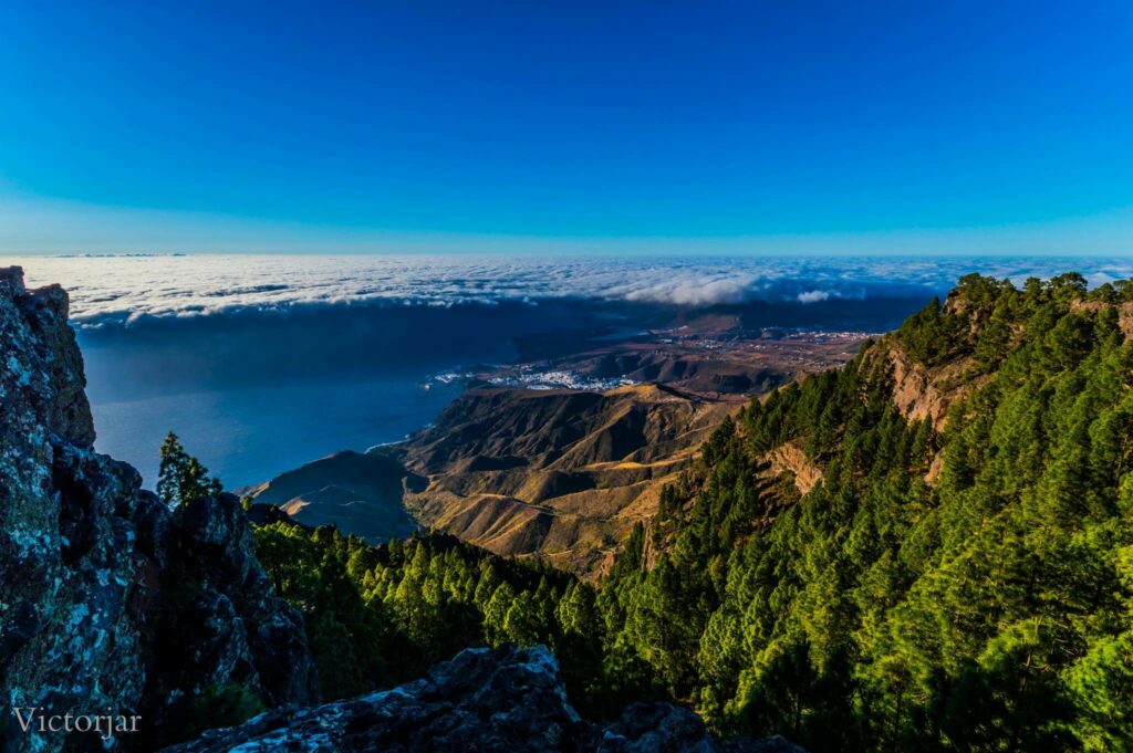
5. Tamadaba Natural Park: A Hiker’s Paradise
In the northwest of the island lies Tamadaba Natural Park, a sanctuary of untouched wilderness. This park offers a variety of trails through dense pine forests, rugged cliffs, and dramatic coastal views. It’s a peaceful area, perfect for hikers looking to escape the crowds and immerse themselves in nature’s tranquility.
Overview
- Location: Northwestern Gran Canaria, Canary Islands, Spain
- Trailhead: Common starting points include the towns of San Pedro, Artenara, and Agaete
- Starting Point: Area recreativa de Tamadaba.
- Elevation: Ranges from sea level to around 1,444 meters (4,738 feet) at Pico de la Bandera
- Difficulty: Varies from easy to challenging, depending on the chosen route
- Duration: 2-8 hours, depending on the trail
- Best Time to Hike: Year-round, with spring and autumn offering the most pleasant weather
Popular Trails
- Circular Route from San Pedro: This moderate trail starts from the village of San Pedro and takes you through lush valleys and pine forests, offering stunning views of the Agaete Valley.
- Distance: 8-10 km
- Duration: 4-5 hours
- Highlights: Lush vegetation, mountain views, and serene picnic spots.
- Agaete to Tamadaba Ridge: A challenging hike starting from Agaete and ascending to the Tamadaba Ridge. This trail offers breathtaking views of the Atlantic Ocean and the rugged coastline.
- Distance: 12-15 km
- Duration: 6-8 hours
- Highlights: Dramatic cliffs, ocean views, and diverse flora.
- Artenara to Pico de la Bandera: This trail from Artenara to the highest point in Tamadaba offers panoramic views of the entire park and beyond.
- Distance: 10-12 km
- Duration: 5-6 hours
- Highlights: Sweeping vistas, rock formations, and forest paths.
Points of Interest
- Pine Forests: The dense Canary Island pine forests are a hallmark of Tamadaba, offering shade and a tranquil atmosphere.
- Dramatic Cliffs: The park is home to some of the most dramatic cliffs and ravines on the island, providing stunning backdrops and photography opportunities.
- Flora and Fauna: Tamadaba supports a wide variety of plant and animal life, including endemic species such as the blue chaffinch and the Canarian juniper.
- Traditional Villages: Nearby villages like Artenara and San Pedro offer a glimpse into traditional Canarian life, with charming streets and local cuisine.
Tips
- Start Early: Begin your hike early in the morning to avoid the midday heat and ensure you have ample daylight.
- Pace Yourself: Some trails can be strenuous, especially those with significant elevation gain. Take breaks to enjoy the scenery and stay hydrated.
- Ideal for a full-day adventure, with picnic spots available.
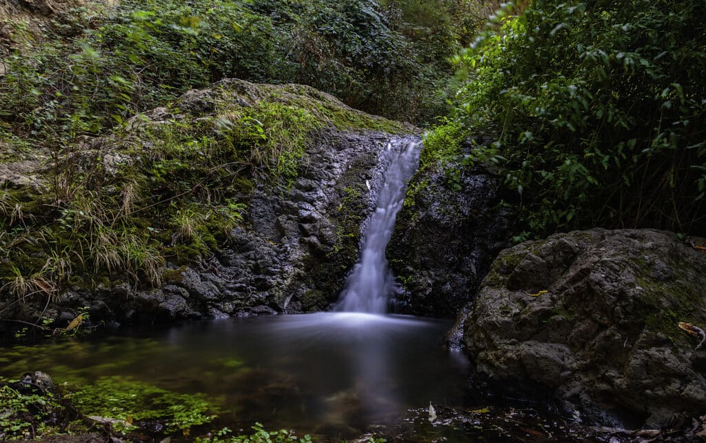
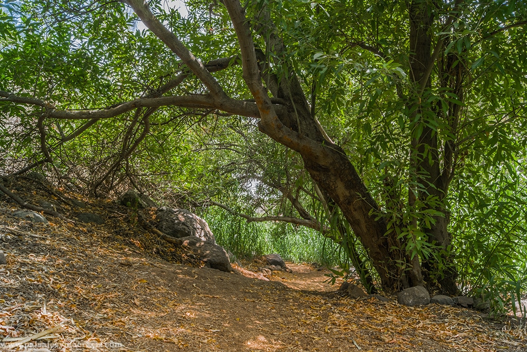
6. Barranco de Azuaje: A Lush Oasis
Located near Firgas in the northern part of the island, Barranco de Azuaje is a lush ravine that promises a tranquil escape. This trail meanders alongside a lively stream, leading you through dense vegetation and small, picturesque waterfalls. The ruins of an old spa nestled in the ravine add a historical touch, making this hike a journey through both nature and time.
Hike Overview
- Location: Northern Gran Canaria, Canary Islands, Spain
- Trailhead: Common starting points include the towns of Firgas and San Andrés
- Elevation: Varies along the trail, with moderate inclines
- Difficulty: Easy to moderate
- Duration: 2-4 hours round trip, depending on the chosen route and pace
- Best Time to Hike: Year-round, with spring and autumn offering the most pleasant weather.
- Trail Description: The trails are well-marked and take you through a lush valley with abundant flora, natural springs, and historical ruins.
Points of Interest
- Firgas: Known for its beautiful water features and tiled promenade, this charming town is a great place to start your hike.
- Old Mills: Explore the ruins of historical mills that were once powered by the ravine’s water.
- Natural Springs: Take a break at one of the many natural springs along the trail. The water is clean and refreshing.
- Endemic Flora and Fauna: The ravine is home to various plant and animal species, including some that are endemic to the Canary Islands.
7. Montaña de Tauro: Panoramic Peaks
For those seeking a challenging hike with breathtaking rewards, Montaña de Tauro near Mogán in the western part of Gran Canaria is a must-visit. The ascent to the summit is steep and demanding, but the panoramic views of the island’s interior and coastline from the top are truly spectacular. It’s a trek that promises both a physical workout and a visual feast.
Hike Overview
- Location: Gran Canaria, Canary Islands, Spain
- Trailhead: Typically starts from the town of Mogán or Tauro village
- Elevation: Approximately 1,200 meters (3,937 feet)
- Difficulty: Moderate to challenging
- Duration: 4-6 hours round trip, depending on pace and starting point
- Best Time to Hike: October to May, avoiding the summer heat
- Trail Description: The trail ascends gradually, passing through diverse landscapes including pine forests, rocky outcrops, and open ridges.
Points of Interest
- Roque Nublo: Visible from the summit, this iconic rock formation is one of Gran Canaria’s most famous landmarks.
- Tejeda: The picturesque town of Tejeda, nestled in the mountains, can be seen in the distance.
- Wildlife: Keep an eye out for native birds and other wildlife unique to the Canary Islands.
Tips
- Start Early: Begin your hike early in the morning to avoid the heat and have ample daylight.
- Pace Yourself: The trail can be strenuous. Take breaks and enjoy the scenery.
- Respect Nature: Stick to marked paths, and carry out all trash. Preserve the natural beauty for others to enjoy.
- Photography: Bring a camera or smartphone to capture the stunning vistas. Sunrise and sunset offer particularly spectacular lighting.
8. Barranco de los Cernícalos: Verdant Retreat
Situated near Telde in the east, Barranco de los Cernícalos is a hidden green haven. This ravine is shaded by lush vegetation, making it a refreshing retreat, especially in warmer weather. Follow the stream and discover small waterfalls along the way, immersing yourself in the natural beauty and serenity of this secluded spot.
Hike Overview
- Location: Telde, Gran Canaria, Canary Islands, Spain
- Trailhead: Common starting points include Lomo Magullo and La Solana. Both offer parking areas and clear access to the trail.
- Elevation: Moderate elevation gain, suitable for various fitness levels
- Difficulty: Easy to moderate
- Duration: 2-3 hours round trip, depending on pace and starting point
- Best Time to Hike: Year-round, with spring offering the most vibrant scenery
- Trail Description: The trail winds through a verdant ravine, following a stream with several small waterfalls. It’s a relatively easy hike with a well-defined path.
Points of Interest
- Waterfalls: The main waterfall near the end of the trail is a must-see. It’s a beautiful spot to rest and enjoy the natural surroundings.
- Stream Crossings: There are several stream crossings along the trail. Most are easy to navigate with stepping stones or small bridges.
- Flora and Fauna: The ravine’s unique microclimate supports a rich variety of plant and animal life.
- Lush Vegetation: The ravine is home to a variety of native plants, including ferns, laurels, and wildflowers.
- Waterfalls: Several small waterfalls along the trail provide perfect spots for photos and rest breaks.
- Birdwatching: Keep an eye out for the namesake kestrels (cernícalos) and other bird species.
Tips
- Start Early: Begin your hike early to enjoy the peace and avoid any potential crowds.
- Pace Yourself: Although the hike is not very strenuous, take your time to enjoy the scenery and take breaks as needed.
- Respect Nature: Stick to the marked paths, do not pick plants, and carry out all trash. Preserve the natural beauty of the area.
- Photography: The lush greenery and waterfalls provide excellent photo opportunities. Bring a camera or smartphone to capture the beauty.
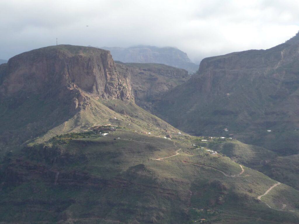
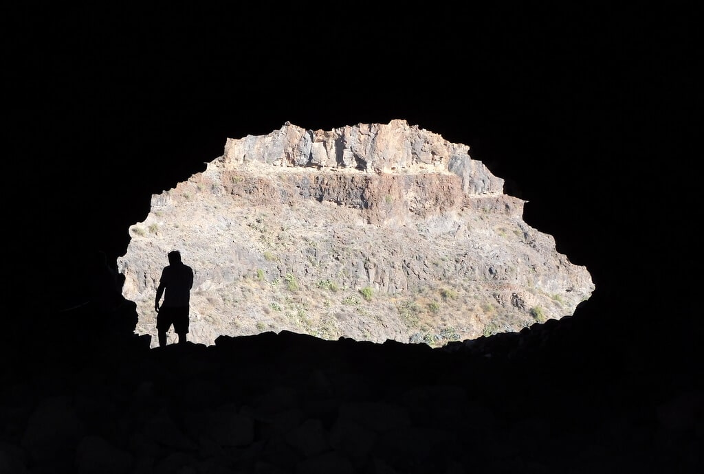
9. La Fortaleza: Archaeological Adventure
Near Santa Lucía de Tirajana in the southeast, the trail to La Fortaleza leads to an ancient archaeological site adorned with caves and rock carvings. The panoramic views of the surrounding valleys and mountains add to the allure, making this hike a perfect blend of natural beauty and historical intrigue
Hike Overview
- Location: Near Santa Lucía de Tirajana, Gran Canaria, Canary Islands, Spain
- Trailhead: The hike typically starts from the visitor center in La Sorrueda, which offers parking and information about the site
- Elevation: Approximately 300 meters (984 feet)
- Difficulty: Easy to moderate
- Duration: 2-3 hours round trip, depending on the route and time spent at the archaeological sites
- Best Time to Hike: October to May, avoiding the summer heat
- Trail Description: The trail ascends gradually, winding through the rugged terrain of Gran Canaria’s interior. It passes through areas of significant archaeological interest.
Points of Interest
- Archaeological Sites: Explore the caves and rock shelters that provide a glimpse into the lives of the island’s ancient inhabitants. Information panels detail the archaeological findings.
- La Fortaleza Grande and La Fortaleza Chica: These twin rock formations are the main attractions. They were used by the indigenous Canarians as refuges and ceremonial sites.
- Caves and Rock Art: The area is dotted with caves that were used for habitation and rituals. Some contain rock carvings and paintings.
- Visitor Center: Start your visit here to gain insight into the historical significance of La Fortaleza. The center offers exhibits and educational materials.
- Natural Beauty: The trail passes through diverse landscapes, including arid cliffs, lush ravines, and dramatic rock formations.
Tips
- Start Early: Begin your hike early in the morning to avoid the heat and have ample daylight for exploring the archaeological sites.
- Pace Yourself: Take breaks to enjoy the scenery and examine the archaeological features. There’s a lot to see and learn along the way.
- Respect the Site: Stick to marked paths and do not disturb the archaeological remains. Help preserve the area for future generations.
- Photography: Bring a camera to capture the unique rock formations and archaeological sites. The lighting in the early morning or late afternoon can be particularly striking.
Conclusion
Gran Canaria is truly a hiker’s paradise, offering trails that cater to all levels of experience. Whether you’re seeking challenging climbs or leisurely walks, the island’s diverse landscapes promise unforgettable adventures. So lace up your hiking shoes, pack your essentials, and get ready to explore the natural beauty of Gran Canaria. Happy hiking and don’t forget to visit us!